Experience the Volkswagen Autostadt in Wolfsburg on the move via app
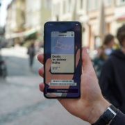
Hamburg, September 08, 2021: Getting to where you want to go without any detours? With the help of apps on our smartphones, we can easily find our way to our destination even in unfamiliar cities. At the Autostadt in Wolfsburg, the “Autostadt – Mobil Erleben” app now allows visitors to navigate the multi-story building. Thanks to dialog and information in real time as well as individual services, the app enriches the visitor experience and extends it to the digital space.
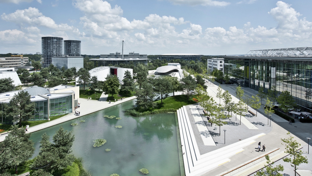
With more than 28 hectares, the Autostadt site in Wolfsburg by german Volkswagen is as large as almost 40 soccer fields. And that’s not all – in addition to the outdoor areas, the theme and adventure park also features the cross-brand automobile museum ZeitHaus, the brand pavilions and the world’s largest automobile delivery center, as well as numerous gastronomic offerings. From now on, visitors can also conquer the Autostadt digitally: Using a combined indoor and outdoor navigation of the “Autostadt – Mobil Erleben” app, they can navigate directly to the desired location, determine their current position and call up news, information and individual services at any time. Interested parties can download the app free of charge from the Google Play Store and the App Store. It strictly complies with data protection requirements. A multi-stage opt-in process during registration in the app protects user data from misuse.

Digital and analog experience blend together
In the “Mobile Experience” app, analog and digital experience merge: Based on location data, visitors receive push notifications for orientation as well as information about the location and about attractions and restaurants that are in their vicinity. Daily updated offers are sent at regular intervals via the app, and users also have access to background information, opening hours and price information. A virtual tour guide invites users to explore a sustainability trail specially developed for the “Autostadt – Mobil Erleben” app. With virtual support, visitors discover sustainable projects in the Autostadt – such as the bee colonies located there – at nine stations on a circular route lasting around 20 minutes. Anyone who discovers all the stations and collects 100 points receives a gift in addition to their purchase at the organic bakery “Das Brot”.
Location-based services: Important information in the right place at the right time
The special challenge of navigating reliably and precisely both indoors with several floors and outdoors is possible thanks to a novel app from the Hamburg-based company locandis GmbH. The app for the Autostadt in Wolfsburg was developed in a joint EU research project between locandis and the PFH Private University of Applied Sciences Göttingen and tailored to the special requirements of the Autostadt. Since 2018, locandis managing directors and founders Prof. Dr. Hans-Christian Riekhof and Stefan Brinkhoff have been active in the fields of real-time location systems, so-called Real-Time Location Systems (RTLS), and location-based services. Their idea: to enable visitors to access relevant information based on location and personal preferences. “The location- or target group-specific information reaches guests exactly where they are,” says Stefan Brinkhoff, CTO of locandis. For Autostadt, the PFH researchers and the locandis team have combined the advantages of mobile navigation for both outdoor and indoor areas with gamification elements. Depending on current and also future requirements, the app can be dynamically modified and extended.
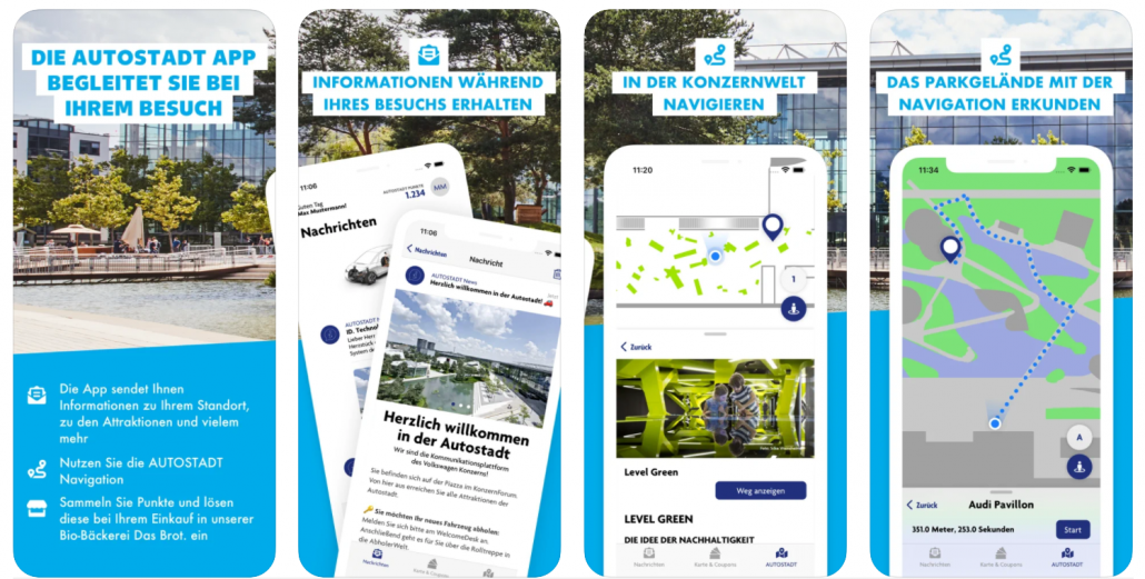
Indoor navigation in the Autostadt – like Google Maps indoors
Localization in real time is also made possible in buildings with several floors by the RTLS system from locandis: users can see on their smartphones where they are and how many meters they are from the location they are looking for. Basically, this works in a similar way to common navigation applications. Inside buildings, however, the GPS signal is often heavily attenuated, which is why common positioning systems fail here. This is why locandis has developed its own technology: Small transmitters, called locators, which use sensor fusion technology. Various sources of information are incorporated into the localization process, such as augmented reality and magnetic field information. Migratory birds also use the latter to reach their destination. The locators also work unerringly: they guide users not only to the desired area, but also precisely to the exhibit they are looking for, for example.
About the project
“Mobil Erleben” is a cooperation between Autostadt and the PFH Private University of Applied Sciences Göttingen. The research project entitled “DeepNav” is being conducted under the direction of Prof. Dr. Hans-Christian Riekhof since mid-June 2020 with funding from the European Regional Development Fund (ERDF) on AR- and AI-based indoor navigation together with locandis GmbH at the PFH Private University of Applied Sciences Göttingen. Locandis GmbH offers comprehensive solutions for real-time locating systems, so-called Real-Time Locating Systems (RTLS). In addition to indoor navigation, which enables better orientation in complex assortments and buildings, the RTLS tech, founded in 2018, focuses on location-based marketing and the implementation of digital loyalty card solutions as an app. In the environment of various industries, locandis delivers ready-to-use B2B solutions as a full-service provider, which includes the areas of consulting, technological implementation of app development, backend and analytics as well as coordinated localization hardware.